Glaciology
Glaciology
InSAR can be used to measure the displacement above the equilibrium lines of tidewater, temperate glaciers, and its seasonal and long-term variability. This variability is critical to assess the impact of climate change in these regions. The ice flow is a function of the basal shear stress and the non-Newtonian rheology, so InSAR data can be used as input of finite element simulations of ice flow.
Glaciology
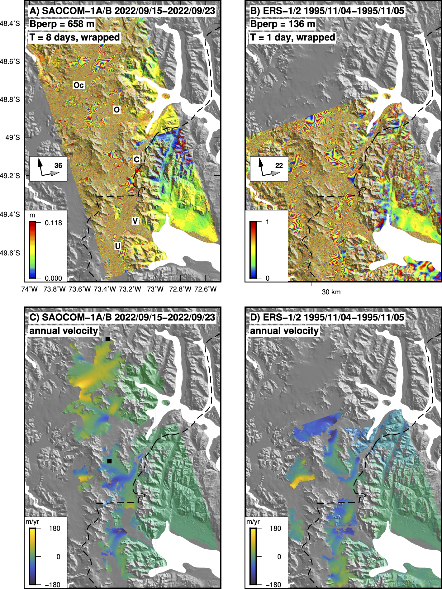
SAOCOM-1 L-band 8-day and ERS-1/2 C-band 1-day interferograms of the Southern Patagonian Icefield. SAOCOM-1 is the only platforms that acquires data suitable for InSAR in these temperate icefields.
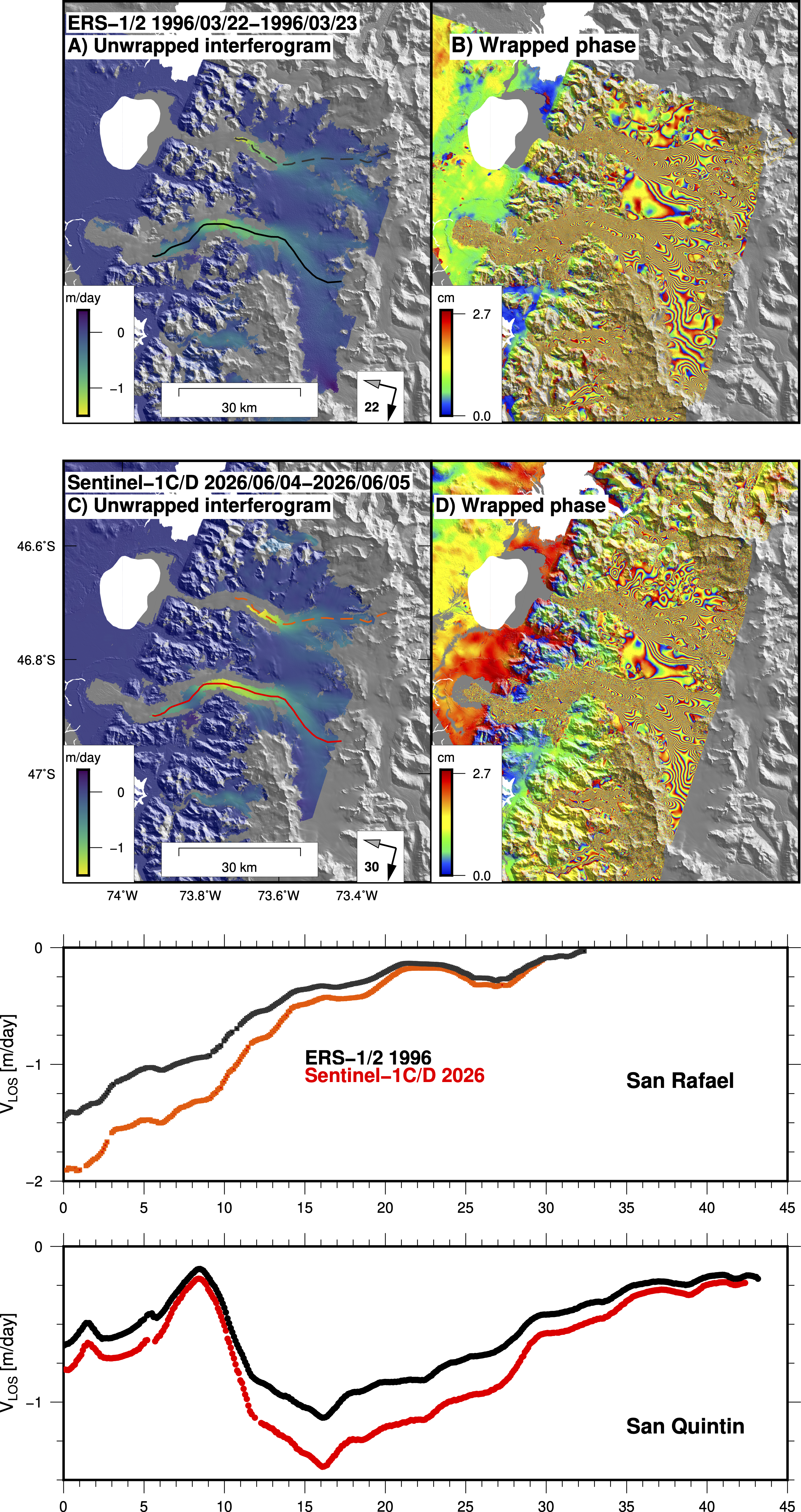
ERS-1/2 C-band 1-day and Sentinel-1C/D C-band 1-day descending interferograms of the Northern Patagonian Icefield spanning 1996 and 2026, respectively. The displacement is measured along the radar line-of-sight, so a negative displacement implies ice motion downslope away from the radar, as expected for a descending orbit. The color lines in the bottom panel show the velocity profiles for the two unwrapped interferograms across the San Quintin Glacier, the second largest glacier of the icefield. It shows that the San Quintin glacier has increased its speed over a 30 year interval.
This is the same kind of analysis than the one shown highlighted in the ESA website: Satellites in tandem reveal 30 years of Antarctic ice flow.
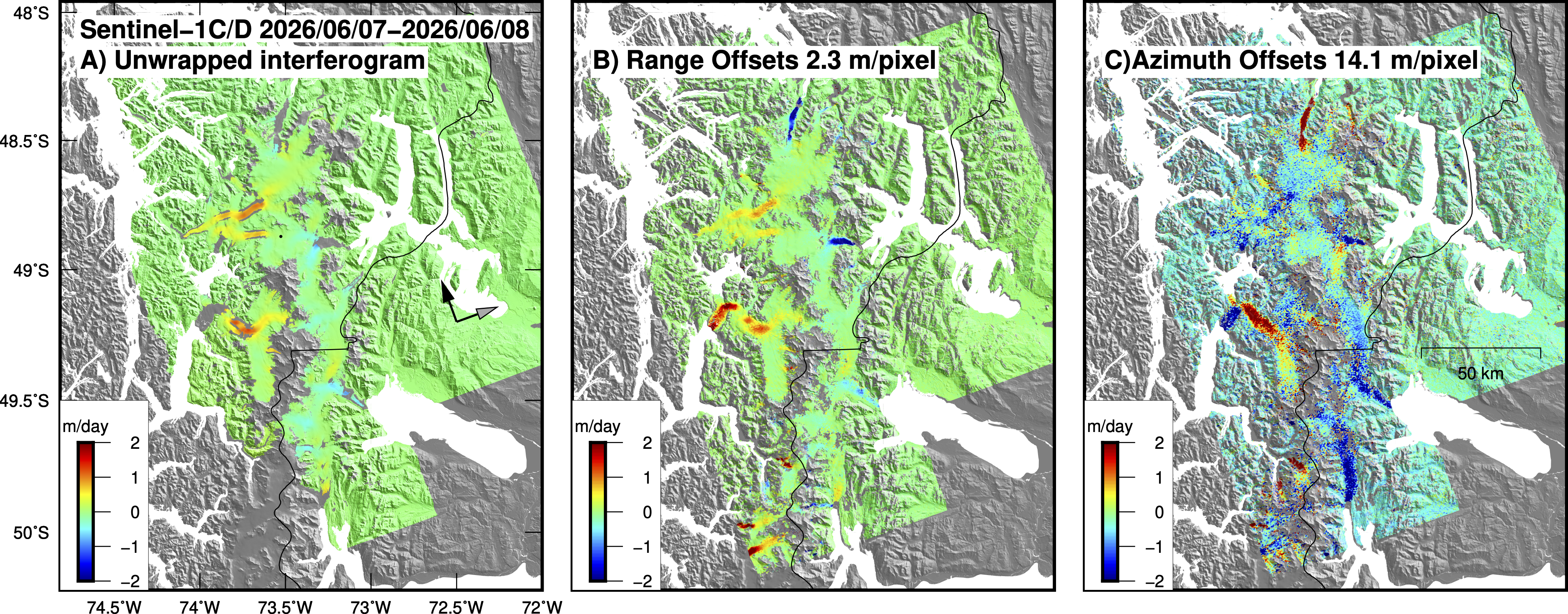
Sentinel-1C/D C-band 1-day ascending interferogram of the northern part of the Southern Patagonian Icefield. The ice velocity is measured along the radar line-of-sight, so a velocity displacement implies ice motion downslope and away from the radar, as expected for an ascending orbit. The black dot is the reference pixel in the middle of the icefield. This is the only type of InSAR data that allows to measure glacier velocity with high resolution and high accuracy along the entire icefield, except on the frontal part of the glaciers that move too fast, leading to coherence loss. In certain regions this 1-day pair can even measure the velocity along the high fringe zones of the glacier shear zones.
Relevant publications
A global assessment of SAOCOM-1 L-band stripmap data for InSAR characterization of volcanic, tectonic, cryospheric, and anthropogenic deformation.
Delgado, F., Shreve, T., Borgstrom, S., León-Ibañez, P., Castillo, J., Poland, M.,2024 IEEE Transactions on Geoscience and Remote Sensing, doi:10.1109/TGRS.2024.3423792.