
Anthropogenic Deformation
Anthropogenic Deformation
Human activity can induce deformation in the crust triggered by fluid extraction among other factors. These deformation signals can be measured from the space with InSAR, its temporal evolution in response to changes in the pumping rate tracked over time, and its impact over groundwater and geothermal resources and infrastructure mitigated.
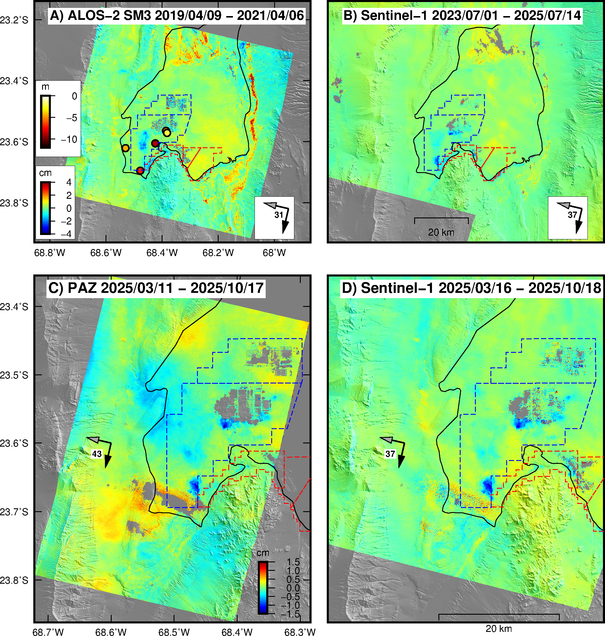
ALOS-2 SM3 (A) and Sentinel-1 TOPS (B) interferograms that show ~2.5 and ~4 cm of line-of-sight (LOS) subsidence during mid 2019 to mid 2021 and mid 2023 to mid 2025 in the Salar de Atacama basin (dashed black line) Delgado et al., 2024. The subsidence results from a drop of ~10 m in the phreatic level in several wells due to brine extraction (yellow to red circles). The brine is extracted and then the water evaporated in plants in the middle of the salar. These plants are areas of very low coherence due to the continuous change of backscatering properties because of the presence of water. The LOS uplift in the SE and E parts (1 and 2 cm respectively) of the salar likely results from a combination of either salt growth and/or soil moisture changes in response to episodic rains triggered by the Andean monsoon. PAZ (C) and Sentinel-1 (D) interferograms that span nearly the same time span of seven months during 2025 and record ground subsidence of 1.5 cm in the SW region of the Salar.
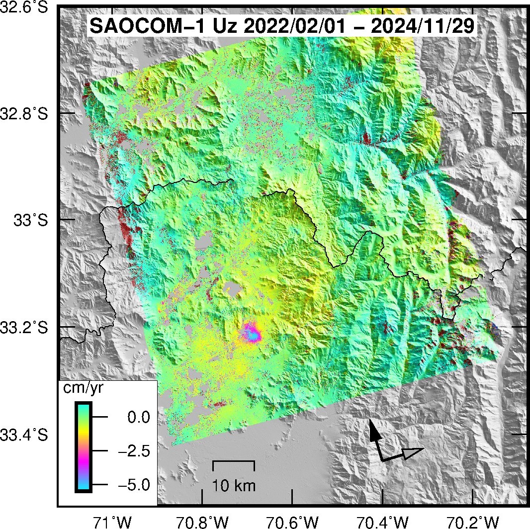
SAOCOM-1 interferogram converted to mean vertical velocity (Uz) that shows 5 cm/yr of subsidence during early 2022 to late 2024 in the city of Colina near Santiago, Chile. The subsidence is most likely due to ground water extraction. This is the fastest anthropogenic subsidence observed so far in Chile. The black line is the limit between the Valparaiso and Metropolitana regions of central Chile.
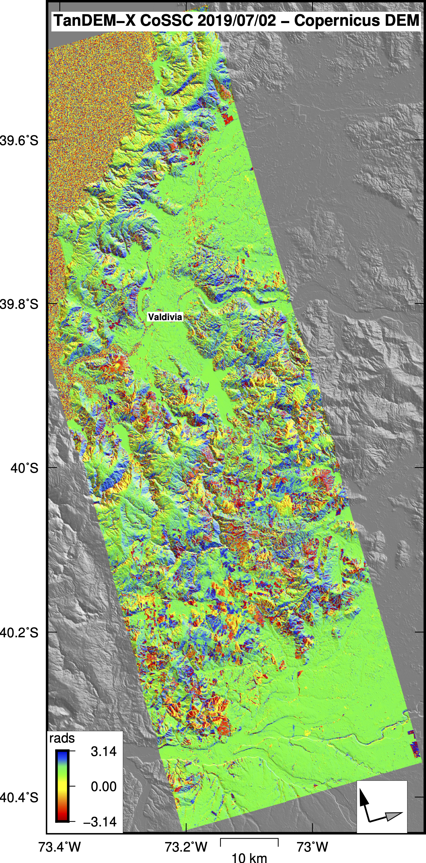
CoSSC TanDEM-X bistatic interferogram that shows elevation changes as phase differences (in radians) with respect to a reference topography (Copernicus 30 m DEM). The elevation changes are due to the logging industry near the city of Valdivia, Chile. Note that the elevation changes are shown as units of wrapped phase in radians.
Relevant publications
A global assessment of SAOCOM-1 L-band stripmap data for InSAR characterization of volcanic, tectonic, cryospheric, and anthropogenic deformation.
Delgado, F., Shreve, T., Borgstrom, S., León-Ibañez, P., Castillo, J., Poland, M.,2024 IEEE Transactions on Geoscience and Remote Sensing, doi:10.1109/TGRS.2024.3423792.
Documenting surface deformation at the first geothermal power plant in South America (Cerro Pabellón, Chile) by satellite InSAR time-series.
Lobos, D., Delgado, F., Pritchard, M., Cardona, C., Franco, L., Pedreros, G., Amigo, A. Journal of Volcanology and Geothermal Research, 2023, in press. doi.org/10.1016/j.jvolgeores.2023.107869.